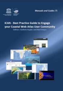
 Editors: Kathrin Kopke and Ned Dwyer
The International Coastal Atlas Network (ICAN) is a community of practice of organizations, who have been meeting since 2006, to share experiences and to find common solutions to Coastal Web Atlas (CWA) development. ICAN is a project of UNESCO IOC´s International Oceanographic Data and Information Exchange (IODE) Programme since 2013 and co-chaired out of MaREI.
The long-term strategic goal of the IODE ICAN (International Coastal Atlas Network) project is to encourage and help facilitate the development of digital atlases of the global coast based on the principle of distributed, high-quality data and information. These atlases can be local, regional, national and international in scale. ICAN aims to achieve this by sharing knowledge and experience among atlas developers in order to find common solutions for coastal web atlas development whilst ensuring maximum relevance and added value for the users.
About ICAN
The International Coastal Atlas Network (ICAN) emerged from a series of trans-Atlantic meetings held in 2006 and 2007 between a group of organisations that shared a common interest in Coastal Web Atlas (CWA) development.
The ICAN grew in subsequent years into a community of practice developing best practise examples for technical solutions to CWA development, scoping and implementing data interoperability approaches and exploring end user interaction with CWAs. Since 2006, the network has organised seven workshops across the globe in Europe, North America and Africa and is increasing awareness of opportunities for coastal and marine information sharing through the CWAs, while growing the ICAN community.
This hand book is conceived as a practical “cookbook” rather than a fully peer-reviewed publication but aims to systematically identify and address issues and challenges related to Coastal Web Atlas (CWA) user interaction through examples and expertise from within the International Coastal Atlas Network (ICAN).
This best practice guide will explore how atlas developers can engage with their user communities through conception, development, implementation, operation and revision of their atlases.
‘We hope that the handbook will allow both new and established CWA developers and hosts to benefit from best practice examples as well as learn from experienced challenges, in order to increase capacity to successfully interact with user communities and target audiences, while managing coastal and marine data and information in a user friendly way. The final product is a resource that hopes to complement and link to a variety of OceanTeacher activities, support IODE training in courses, thereby being of value to all who manage and present marine data and information.’

